Project information:
- Introduction
- Methods
- Tasks
- Progress
- References
- Results
Resources:
Sponsor:
Introduction
|
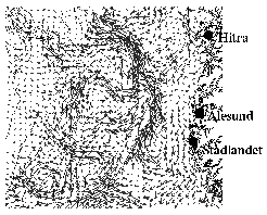
Despite the popularity of ensemble simulations for medium-range and long-range forecasts in meteorology, similar activities are rather sparse in the ocean modeling community. The activities that are known to us focus on seasonal to interannual forecasts with coupled atmosphere and ocean models. One such activity is the EU project "DEMETER". Ensemble simulations are mostly used for investigations of error growth in large scale coupled models and regional scale ocean models (e.g., Lermusiaux [1999]). However, the aspect of deterministic vs. non-deterministic circulation features may also be examined from ensemble simulations for longer periods than the time scale of error growth [Metzger et al., 1994]. Ensemble simulations as a tool for ocean circulation forecasts and studies is expected to gain in popularity in the near future, since the prospected speed and memory capacity of high performance computers will allow for semi-global/global eddy resolving simulations within the next few years. In the 20th century, the details of the ocean circulation of the Skagerrak, the North Sea, the Norwegian Sea and the Barents Sea emerged continually. In an early work, Mohn [1887] described the Norwegian Coastal Current (NCC) as a smoothly flowing current of a relatively broad horizontal extent. The first indications of a much more complex circulation were observed and reported by Helland-Hansen and Nansen [1909]. They speculated that the wave-like structure of isotherms and isohalines they had found in the NCC ("puzzling waves of the equilines in vertical sections") was related to internal waves and ocean eddies. Moreover, Helland-Hansen and Nansen observed features in the Norwegian Atlantic Current which they interpreted as (possibly stationary) eddies. Sćtre and Ljřen [1972] provided additional details, and in his description of the surface circulation, Sćtre [1983] described the NCC and adjacent waters as being abundant with eddies. With the advent of satellite imagery during the past 20 years or so, the abundance of eddies in the vicinity of coastlines and ocean fronts is seen to be the most striking feature of the ocean circulation. In this document, the phrase "(oceanic) mesoscale features" alludes to features on the scale of the "ocean's weather" and includes filaments, meanders and eddies in the ocean. These features are evident in the eddy resolving operational simulations that are run by the Norwegian Meteorological Institute (met.no) at all times [Furnes et al., 2001; Engedahl, 2001]. (These models have a spatial resolution of 4 km, and receive their boundary values from a 20 km model of the Norwegian Sea and adjacent ocean regions.) Hence, it is clear that numerical ocean circulation models are capable of qualitatively reproducing the features of the ocean's mesoscale. However, due to the lack of data assimilation in these simulations, the positioning and timing of events on the mesoscale may well be in error. The mesoscale circulation is accompanied by entrainment of nutrient-rich waters from intermediate depths (e.g., Rřed and Shi [1999] and references therein). Hence, with respect to e.g. the production of biomass, these are salient features of the circulation. The main goal in this project will be to quantify the variability in space and time of the mesoscale features by an examination of the role of deterministic and non-deterministic behavior of the ocean circulation. In the present context, aspects associated with the deterministic circulation include wind forcing, bottom topography and coastline curvature. The non-deterministic aspect is associated with flow instabilities. |
Mesoscale circulation features are generated by flow instabilities, and are generally of a non-deterministic nature. However, certain regions are known to be "eddy benign", i.e., there are sites that are known to be preferential for mesoscale genesis. These sites are found on all latitudes at some distance from the equator, and include the Agulhas retroflection off South Africa [Boudra and Chassignet, 1988], the eastern Mediterranean [POEM group, 1992], the Gulf of Alaska [Tabata, 1982] and the coastal region off the southern tip of Norway [Rodhe, 1998]. These regions are particularly abundant in eddies due to bottom topography [e.g. Swaters and Mysak, 1985], coastline curvature [e.g. Rřed, 1980] and/or ocean fronts [e.g. Ĺdlandsvik et al., 2001]. At least the two former (bottom topography and coastline curvature) may give rise to deterministic behavior of the ocean's mesoscale. (In their study, Heim et al. [1992] found that eddy features vanish in the absence of topography.) However, it is unclear whether the preferential regions of formation are sufficiently constrained with respect to the relevant horizontal scales. Also, the timing of eddy generation possibly has a significant deterministic component, since such generation may be linked to the history of the wind forcing. We will also describe relations between the surface circulation and the water masses below, and the associated variability. Such information is pivotal in state-of-the-art data assimilation techniques, in which observations of the ocean surface are extrapolated in the vertical. Here, we will be able to quantify the part of the variability of the surface signals' penetration depths that is associated with uncertainties in the initial state of the ocean. In this study, we will limit the time-dependent source for variability to the wind forcing. However, other aspects of ocean circulation may also contribute to the deterministic part of the mesoscale, notably river runoff and tides. |